 Narrowsburg
Light Rain Fog/Mist, 43°
Wind: 8.1 mph
 Narrowsburg
This map of Honesdale from 1851 is valuable not only for its basic information on street names and homeowners but also for its drawings of important buildings, most of which disappeared many years …
Stay informed about your community and support local independent journalism.
Subscribe to The River Reporter today. click here
This item is available in full to subscribers.
Please log in to continue |
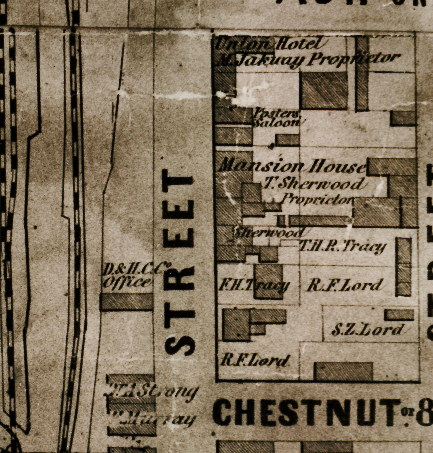
This map of Honesdale from 1851 is valuable not only for its basic information on street names and homeowners but also for its drawings of important buildings, most of which disappeared many years ago. Shown is the block between 8th and 9th streets on Front (now Main) Street. On the left is the Delaware & Hudson Canal Company office and across the street is the mansion of Russell F. Lord, superintendent of the canal company. The original D&H office was replaced in 1860 and is now the main building of the Wayne County Historical Society museum.
Thanks to the canal and gravity railroad, the laurel swamp at the confluence of the Dyberry Creek and Lackawaxen River had become a prosperous, bustling town and by 1851 was the county seat, replacing Bethany, the original center of population. Ambitious young men had flocked to the new canal town and, by 1850, had built churches, schools and mansions. Note that there were two hotels on the same block as the Russell mansions, serving the commercial travelers drawn to the canal town.
From the files of the Wayne County Historical Society. The museum and library are open 10 a.m. to 4 p.m. Wednesday through Saturday.


Comments
No comments on this item Please log in to comment by clicking here